See at a glance which facilities, destinations, and locations are within reach. That’s what our Routing Engine does for every address in the Netherlands, for every trip at any moment.
A better accessibility of cities and new residential and work locations is a challenge for many governments and companies. Travel time contours provide valuable insights here. For example, they show where investments in public transport, cycling, and pedestrian facilities may be needed. They also show which locations are suitable for new housing. In this way, travel time analyses can support decision-making in mobility planning and area development.
Travel contours represent accessibility in distance and time. We calculate these for different modes of transport: car, public transport, bicycle, e-bike, and walking. We also calculate travel time and distance for multimodal trips. For a public transport analysis, we include the walking segments before and after the trip. Finally, we visualize accessibility as contours (“isochrones”) on the map, using intervals (e.g., 5, 10, and 15 minutes).
We create these accessibility analyses using routing technology. This calculates the distance and time of a trip across the network. This is much more accurate than a straight-line distance. It also often proves more valuable to express a trip in terms of travel *time* rather than travel *distance*. We calculate public transport trips based on the timetable, which means that the time of day is taken into account in the analysis.
Pricing and conditions
The routing engine can be integrated as API and is available as a software module. Would you like more information about our offer? We are happy to explain the different options to you.
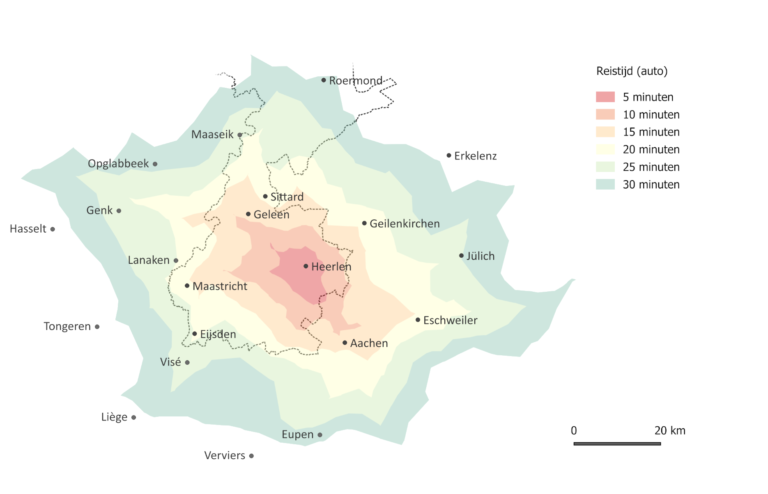
For many border regions, the border forms a barrier that limits economic opportunities. That’s why we also calculate cross-border accessibility (not yet available for public transport). This gives governments and companies more insight into the potential for employment and customers on the other side of the border.
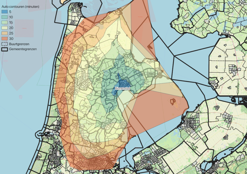
City centre of Hoorn: accessibility by car
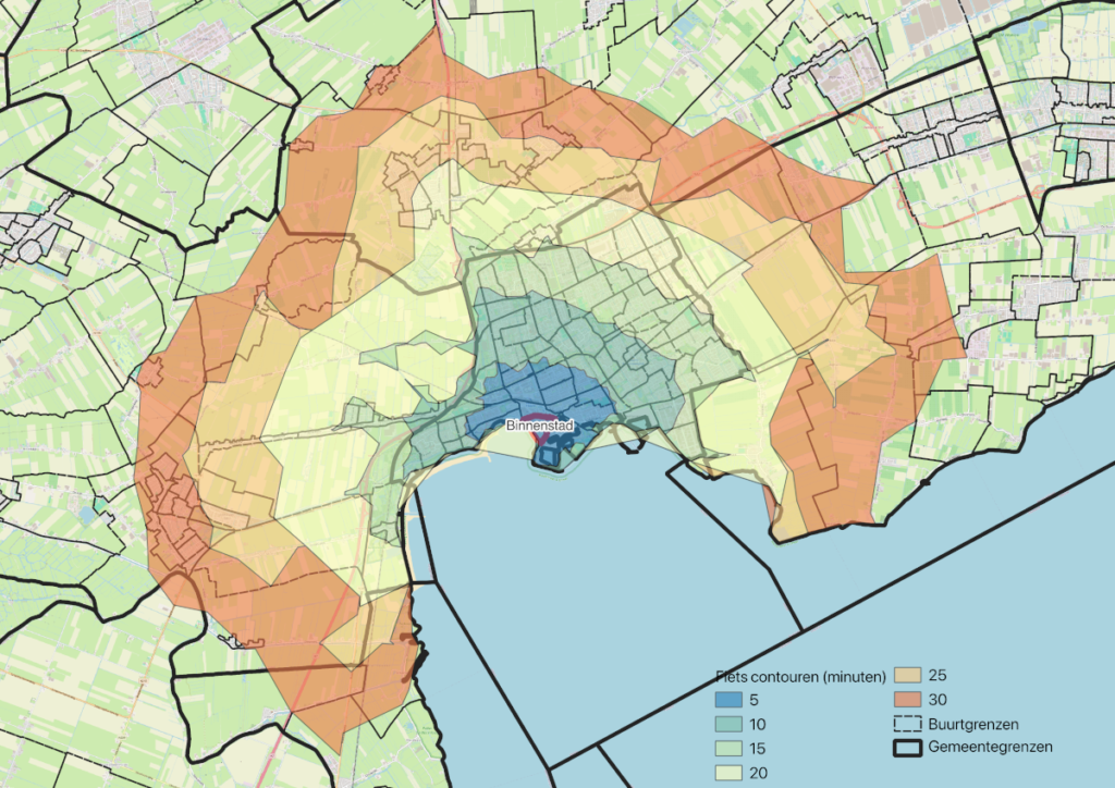
City centre of Hoorn: accessibility by bicycle
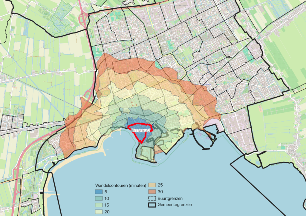
City centre of Hoorn: accessibility on foot
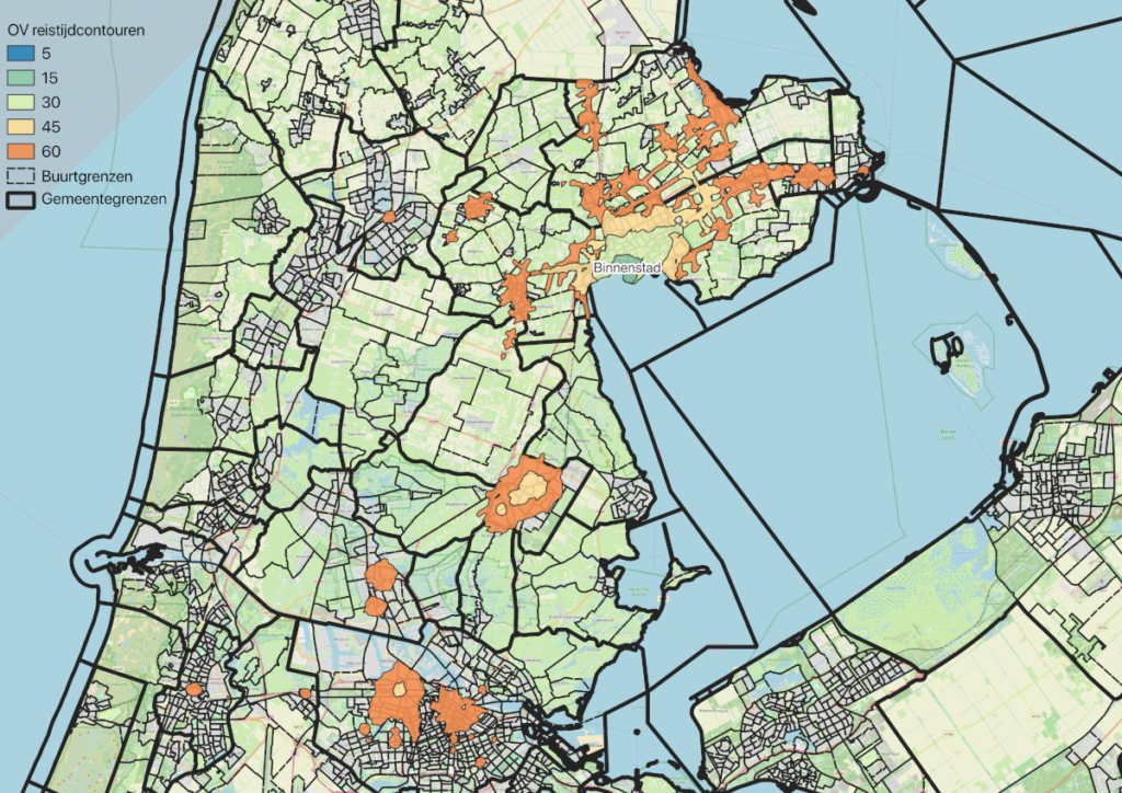
City centre of Hoorn: accessibility by public transport
Level of facilities and accessibility of amenities
Alongside accessibility, we calculate the proximity of facilities such as public transport stops, educational institutions, and medical services. We do this for every location in the Netherlands. In various sectors, different parties benefit from this:
Public sector: determining the service area
(SME) businesses, project developers: determining the market area
Housing market: showing home seekers how a property scores in terms of accessibility to amenities
Employers: being attractive to new talent by being accessible
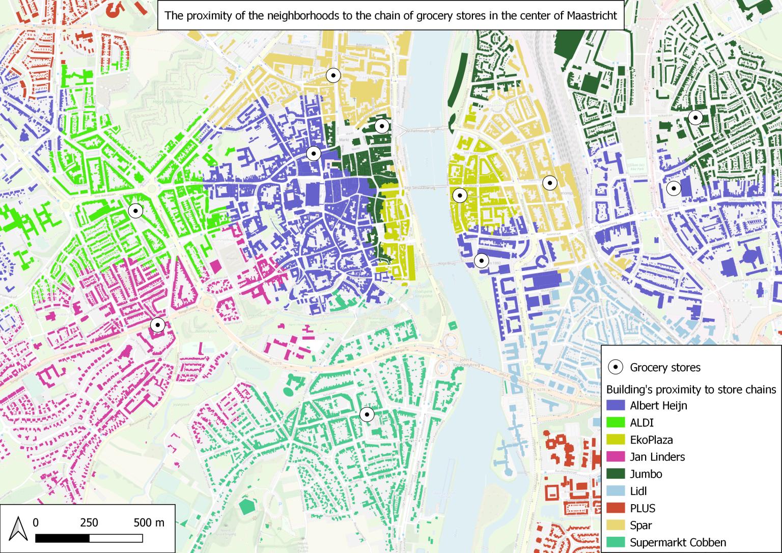
Accessibility of supermarkets
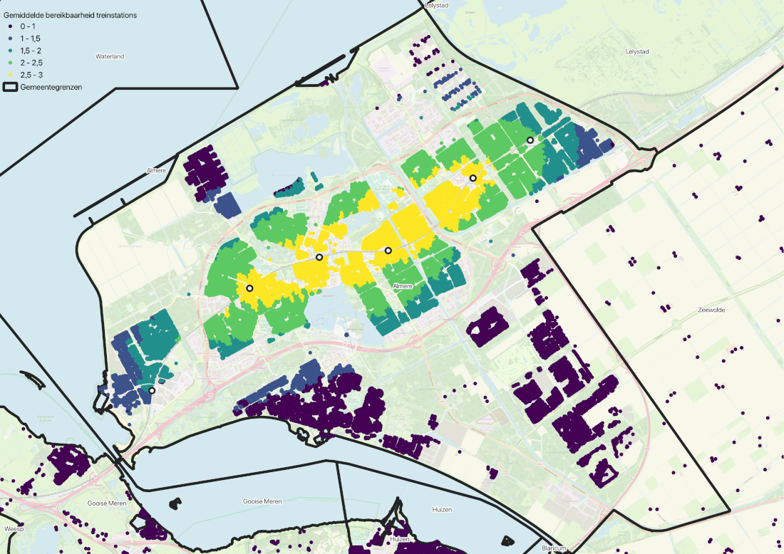
Accessibility of train stations (Almere)
User friendly information for your online customer
Visitors of job sites, housing sites, and booking platforms want to see accessibility information at a glance. Where is the nearest school, doctor, or supermarket? Which restaurants and tourist attractions are within reach? Which employers fall within my ideal travel time? We calculate this for the mode of transport preferred by the user: walking, cycling, car, public transport, or a combination. This information can be integrated into your booking or housing platform.