TRAFFIC SAFETY
Students on the map
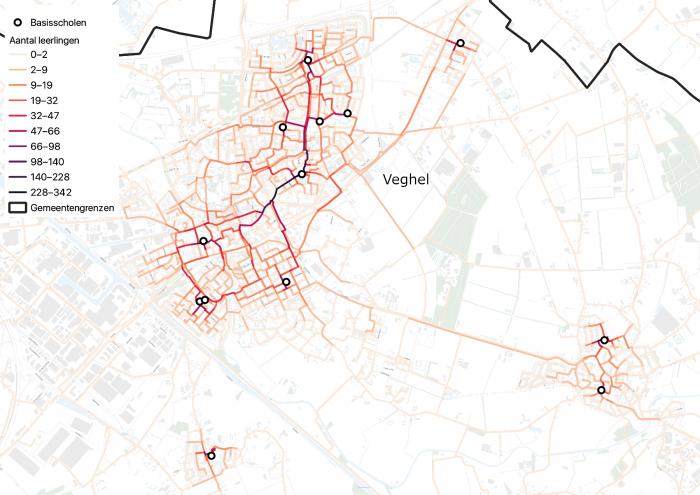
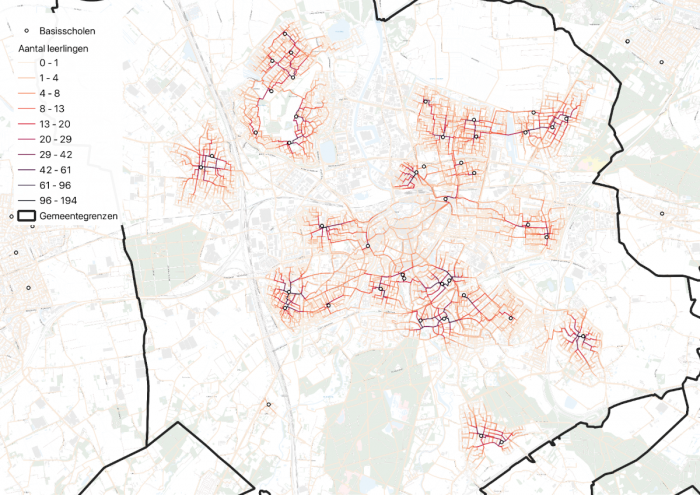
For the Brabant municipalities of Breda and Meierijstad, we calculated the routes of all primary and secondary school students. This made it possible to improve bicycle safety at specific locations.
Routes from home to school
For the Brabant municipalities of Breda and Meierijstad, we mapped the walking and cycling routes of students. Our model shows exactly where students are located on the cycling and walking network. Based on this model, the municipalities made the cycling connections safer.
Every day, around 300,000 secondary school children (30%) travel to a different town on their way to school. Along the way, they encounter a large number of unsafe situations. The municipality of Breda and the municipality of Meierijstad took the initiative to bring about change.
StraTopo and Dutch Cycling Intelligence developed a new, data-driven approach. It combines slow-traffic policy with advanced data-analysis techniques. This provides insight into the walking and cycling behavior of students. Based on the results, high-risk locations were immediately improved in practice.
Thanks to routing technology, StraTopo can calculate all possible routes in the Netherlands, including those of students on their way to school. We linked the locations of students at postcode level (PC4) to spatial and (geo)demographic data. This provided insight into network usage at street level that would not have been possible otherwise.
We used multiple data sources:
- Home and school locations of students (not traceable to individuals);
- The road network;
- GPS data on the actual use of the network.
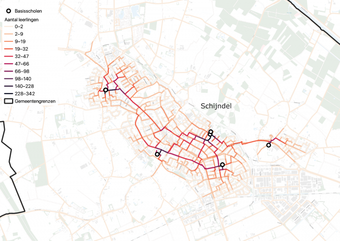
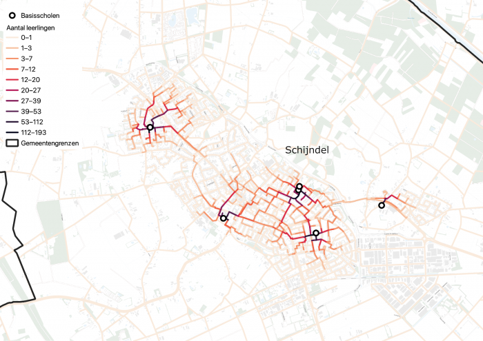
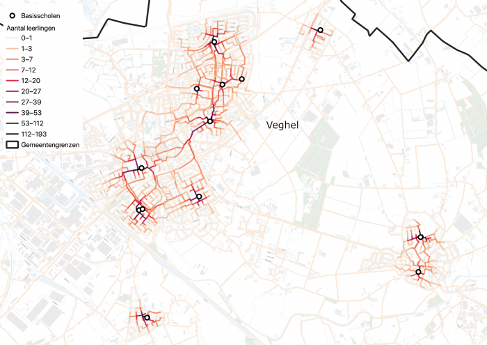
Paper: Safe to School and Back
Data-driven policy innovation for young road users
On April 11, we will present this data-driven approach at the National Traffic Safety Congress 2024. Read the paper Safe routes for schoolchildren.
Presentations
April 11 – National Traffic Safety Congress 2024
At the National Traffic Safety Congress 2024, Martijn Geervliet from the Municipality of Breda will present “Scholieren op de Kaart” during the session Traffic safety on the way to school or sports.
April 16 – GNMI (Municipal Network for Mobility and Infrastructure)
We are presenting Scholieren op de Kaart to the GNMI (Municipal Network for Mobility and Infrastructure) during the GNMI Traffic Safety meeting.
Get in touch
Would you like to have this analysis made for the students in your municipality or for the pupils at your primary or secondary school? Feel free to get in contact.


